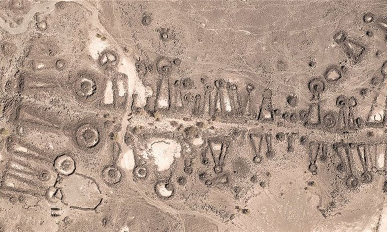
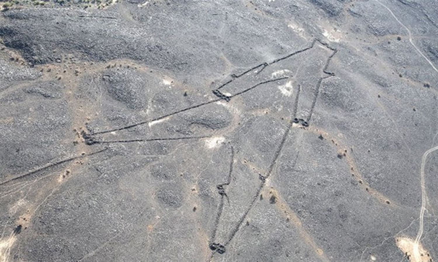
Increased access to aerial photography and satellites has opened up high-resolution windows to the map of Arabia and its surrounding region revealing an impressive array of rock structures known as desert kites.
The dry stone-built structures comprising long walls ending in an enclosed area were first discovered in the 1920s when World War I pilots flying over the Levantine and northern Saudi deserts reported seeing constructions resembling polygons, funnels, and triangles.
Scholars have various theories on the purpose of the kites, some believing them to be villages or traps for herding animals, while others consider them tombs.
